


Swansea And Gower - Sheet 159
Publisher: Ordnance Survey
Format: Paperback
ISBN: none
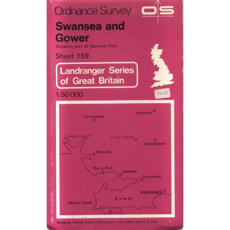
Swansea and Gower – Sheet 159 (1981) – Ordnance Survey
Ordnance Survey | Landranger Series | ISBN: None
Condition: Good | Sold by Crappy Old Books
Swansea and Gower. A glorious corner of South Wales where rugged coastlines, sweeping beaches, rolling hills and picturesque villages combine to produce scenery so magnificent that even the most determinedly miserable visitor might be persuaded to stop complaining about the weather for several minutes. Here, the Atlantic Ocean meets the Welsh countryside, the roads become increasingly narrow, and the landscape offers endless opportunities for getting pleasantly lost, provided one has remembered to bring a decent map.
Fortunately, Ordnance Survey has been anticipating precisely this problem for generations.
Welcome to Swansea and Gower – Sheet 159, a vintage 1981 edition from the celebrated Landranger Series of Great Britain, published at the wonderfully practical scale of 1:50,000. Two centimetres on the map represents one kilometre on the ground, although anyone attempting to walk that kilometre across muddy Welsh hills in a driving rainstorm may find the experience somewhat longer than the mathematics suggests.
The map covers Swansea, the Gower Peninsula and surrounding parts of South Wales, including places such as Llanelli, Kidwelly, Carmarthen, Ammanford and Llandeilo. It offers a fascinating cartographic portrait of a region combining industrial heritage, agricultural countryside, historic settlements and some of the most spectacular coastal scenery in Britain.
The Gower Peninsula itself has a particular claim to fame, having become Britain’s first designated Area of Outstanding Natural Beauty in 1956. Its dramatic limestone cliffs, sandy beaches, secluded coves and sweeping coastal landscapes have attracted generations of walkers, holidaymakers and people who simply wish to sit somewhere beautiful while pretending that their responsibilities no longer exist.
Among its celebrated landmarks is Worm’s Head, the extraordinary tidal headland extending into the sea near Rhossili, where visitors can discover that the difference between a pleasant coastal walk and an unexpectedly complicated afternoon depends rather heavily upon the tide.
Swansea, meanwhile, brings its own distinctive combination of maritime history, industrial development and cultural heritage, while the surrounding towns and villages offer a fascinating glimpse into the changing landscape of southern Wales.
Published in 1981, this map is also an intriguing historical document. Roads, settlements, industrial sites and other geographical features have changed considerably over the intervening decades, making older Ordnance Survey editions particularly appealing to local historians and collectors interested in comparing the past with the present.
The wonderfully distinctive red Landranger cover, complete with its original £2.20 price sticker, is itself a pleasing reminder of an era when buying a detailed map of an entire region cost less than a modern cup of coffee.
The cover also promises Tourist Board information and public rights of way, invaluable additions for anyone planning a proper countryside expedition rather than merely driving around admiring the scenery through the windscreen.
This 1981 Ordnance Survey Sheet 159, offered in Good condition by Crappy Old Books, is an appealing acquisition for walkers, vintage map collectors, Welsh local historians and anyone with an affection for Swansea, Gower and the surrounding countryside.
A charming geographical snapshot of South Wales from the days when navigating unfamiliar territory required patience, observation and the occasional roadside consultation conducted with an enormous sheet of paper spread across the bonnet.
And unlike modern satellite navigation, this map will never suddenly direct you down an unsuitable farm track.
Unless, of course, you’ve been holding it upside down.
Keep browsing: See more Maps books Other books by Ordnance Survey
